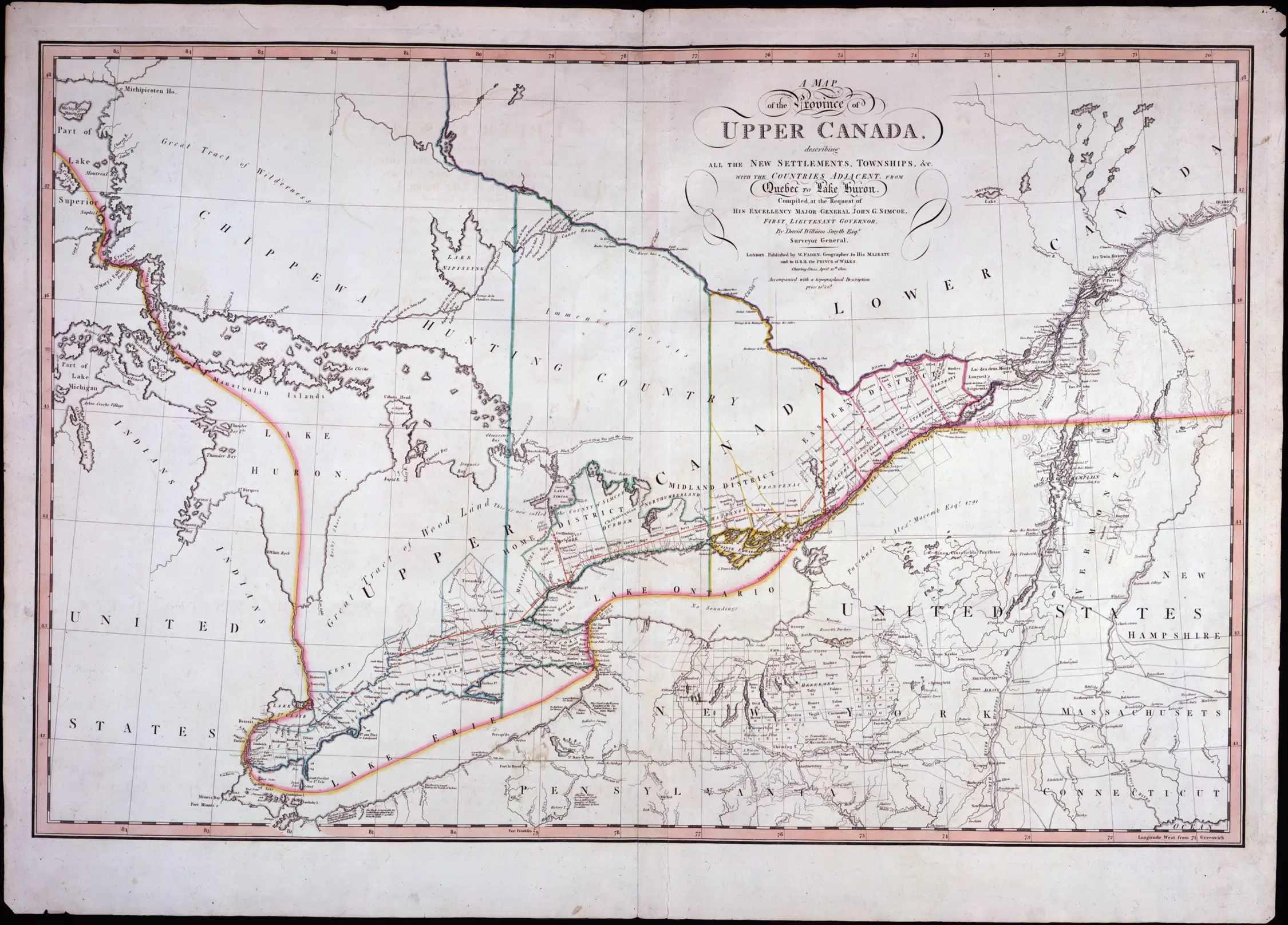
Government of Ontario

Ontario.ca     |    


Ministry of Public and Business Service Delivery


The Changing Shape of Ontario: a Guide to Boundaries, Names and Regional Governments - Page Banner
 

The Evolution of the District and County System 1788-1899

Maps scanned from the Economic Atlas of Ontario / Atlas Économique de l'Ontario W. G. Dean, Editor/ Directeur; G. J. Mathews, Cartographer/ Cartographe Printed 1969 by University of Toronto Press for the Government of Ontario

Map of Ontario Districts - 1788

Click to see a larger version ( 218K)

Province of Ontario, 1788

Map of Ontario Districts - 1792

Click to see a larger version (219K)

Province of Ontario, 1792

Map of Ontario Districts - 1798

Click to see a larger version (223K)

Province of Ontario, 1798

Map of Ontario Districts - 1826

Click to see a larger version (258K)

Province of Ontario, 1826

Map of Ontario Districts - 1838

Click to see a larger version (322K)

Province of Ontario, 1838

Map of Ontario Districts - 1845

Click to see a larger version (353K)

Province of Ontario, 1845

Map of Ontario Districts - 1851

Click to see a larger version (279K)

Province of Ontario, 1851

Map of Ontario Districts - 1882

Click to see a larger version (331K)

Province of Ontario, 1882

Map of Ontario Districts - 1899
Click to see a larger version ( 322K)

Province of Ontario, 1899

[Return to top of page]