Aerial photographs
Find aerial photographs of the Province of Ontario captured between 1920 and 1999.
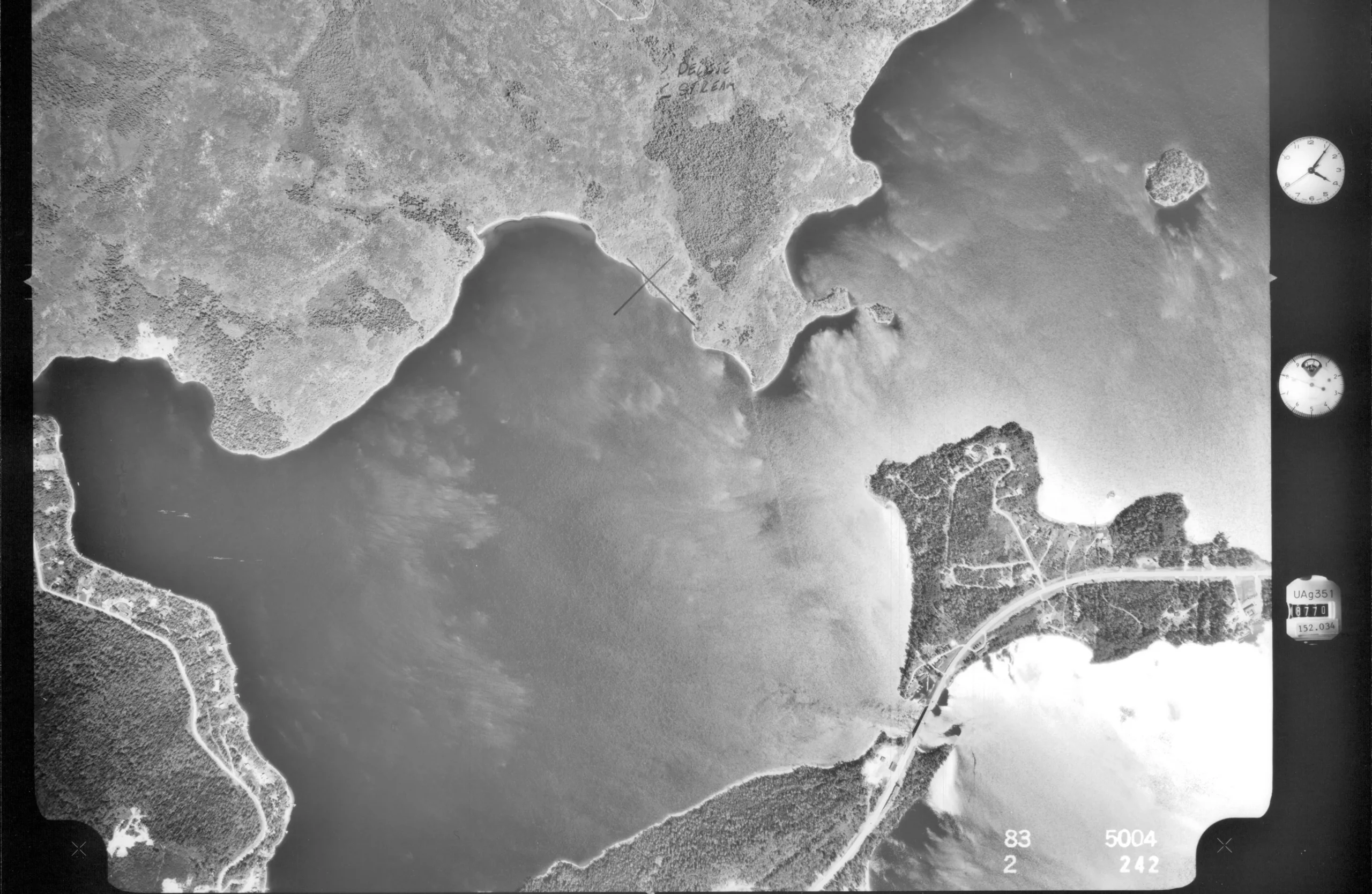
About aerial photographs
Aerial photographs are pictures taken from airplanes, either at an angle or directly overhead. They are usually created for specialized purposes, such as surveying land and forests or for creating topographic maps that depict changes in the elevation of landforms and terrain.
Aerial photography in Ontario dates to at least 1919.
What aerial photographs can tell you
Aerial photographs are rich in historical information, including:
- changes in landscapes, forests and lakes over time
- the urban boundaries at given moments
- evolution of infrastructure across the province
- general property information, including the existence of buildings, roads and water courses
Ministry of Natural Resources aerial forestry photographs
We hold the Forest resource inventory aerial photographic prints (RG 1-429-7) that were created by the Department of Lands and Forests (1946-1972) and Ministry of Natural Resources (1972-1999).
This series includes:
- 946,000+ photographs
- full coverage of province up to James Bay, including cities and towns
- photos of forests at peak canopy (summer) and dormancy (winter)
You can request photos from this collection to view in person in the Reading Room or order reproductions.
Request these photos using our interactive mapping tool
Use our interactive mapping tool to find and request single photos from this series.
How to use this map
- Navigate and zoom to the area you are interested in. Red dots representing individual photos appear at the scale of 2km.
- Select the dot to open an information window. The window includes all the information needed to retrieval the image in our holdings.
- Once you know the photo you want, select the “+” button to automatically add the information into the “selected images” field.
- You can add more photos to the “selected images” field by selecting other red dots and selecting the “+” button.
- You can either order a reproduction or request to view the item(s) in the Reading Room. You must specify the format and delivery method for reproduction orders.
- Input the required personal information (indicated with “*”) and select “submit.”
- Your submission will be assigned to archives staff for processing.
Note: Reproductions requested through this tool will be processed automatically based on the information provided.
McCarthy Aero Service Limited fonds
The McCarthy Aero Service Limited fonds (C 285) consist of aerial photos created or collected by McCarthy Aero Service Limited between 1919 and 1920.
The fonds includes:
- 1,132 black and white photographic prints
- oblique vantage (taken at an angle from the side of the plane)
- depictions of cities and towns and other notable locations across Ontario with some photos from Quebec and the US
Access:
McCarthy was an air services firm based in New Liskard, Ontario incorporated by former Royal Air Force pilots. Besides aerial photographs, the firm provided passenger and freight delivery.
Related records
If you can’t find what you’re looking for in aerial photographs or want to conduct further research, you can try searching related records and resources.
Patent plans are hand-drawn boundary maps for land that was transferred from Crown ownership to private individuals. They provide an illustrated perspective of the evolution of townships, districts and individual properties.
National Air Photo Collection (external resource)
Library and Archives Canada has a robust collection of aerial photos. Images in the collection date to the 1950s and span the entire country. The collection includes black and white and colour photography.
Get research help
We can point you to resources to help you with your research. Contact us.
For professional research help, we have a list of private companies and freelance researchers who can do research on your behalf.