David Thompson fonds

North American David Thompson Bicentennials Partnership
The Archives of Ontario is a proud partner of the North American David Thompson Bicentennials Partnership. This initiative is a three-year continent-wide public and private sector heritage awareness partnership. The partnership will commemorate the character and accomplishments of David Thompson, one of North America’s greatest explorers, map-makers and geographers. Between 1784 and 1850, Thompson explored and mapped 3.9 million square kilometres of North America.
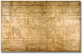
The Archives of Ontario holds the largest collection of Thompson’s original writings, including his journals dated from 1789-1864 and his map of the North-west Territories Territory of the Province of Canada, also commonly known as the “Great Map.”
For more information on the North American David Thompson Bicentennials Partnership go to: www.davidthompson200.org

Map of the North-West Territory of the Province
of Canada by David Thompson, 1814
David Thompson fonds
Reference Code: F 443, R-C(U), AO 1541
Archives of Ontario, I0012850
David Thompson (1770-1857) was an explorer, surveyor, and astronomer for the Hudson Bay Company and the Northwest Company who also completed survey work of the Canada-United States border for the British Government under the Treaty of Ghent.
Biographical Sketch
Born in Westminster, England, Thompson arrived at the Hudson Bay Company post in what is now Manitoba in 1784 and undertook his first fur expedition in 1786. From 1788 to 1797, Thompson held a variety of jobs with the Hudson Bay Company, including teaching, clerical and trade work, and surveying of the river systems in what is now northern Saskatchewan and Manitoba.

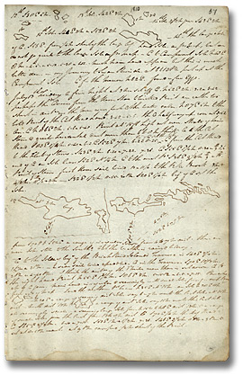
Page from Journal no. 22, 1809-1810
David Thompson Journals and Notebooks
Reference code: F 443-1
Archives of Ontario
In 1797, Thompson left HBC for the North West Company and for the next fifteen years, undertook a number of celebrated surveys, including the survey of the 49th parallel from Lake Superior to the prairies (when he located the source of the Mississippi); the Rocky Mountain surveys of 1800-1801; and the Columbia River voyage from 1807-1812 (undertaken in response to Lewis and Clark's expedition to the Pacific). Thompson completed his well-known map of what are now western Canada and the Northwestern United States in 1814.
In 1817, Thompson was hired as an astronomer and surveyor for the British Commission established under the Treaty of Ghent. He surveyed the border with the United States along the St. Lawrence and the Great Lakes in the early 1820s, and remained with the Commission until 1827.
Thompson also held the position of Justice of the Peace for Glengarry County, Upper Canada, from 1820 until the 1830s. During his later years, Thompson resided in Montreal, where he tried to make a living selling his maps and writing the manuscript of his travel Narrative (which was not published until 1914 by geologist J. B. Tyrell). He died in 1857.
Fonds includes notebooks and journals which document Thompson's journeys into what is now the interior of Canada and the northwest United States, the mapping and surveying of Canada, and relations between fur traders and aboriginal peoples. The fonds also contains field books of boundary surveys conducted by Thompson for the Treaty of Ghent Boundary Commission, miscellaneous outgoing correspondence relating to maps and boundary surveys, and hand-drawn copies of boundary surveys.
The following series are available on microfilm:
Associated Material
- David Thompson fonds (R2825-0-6-E), Library
and Archives Canada/Bibliothèque et Archives Canada
- David Thompson Papers (MS Collection 21), University of Toronto Archives, Thomas Fisher Rare Book Library
Former Codes
MU 2968 to MU 2982.