Government of Ontario

Ontario.ca     |    


Ministry of Public and Business Service Delivery


The Changing Shape of Ontario: a Guide to Boundaries, Names and Regional Governments - Page Banner
 

A Guide to Boundaries, Names and Regional Governments


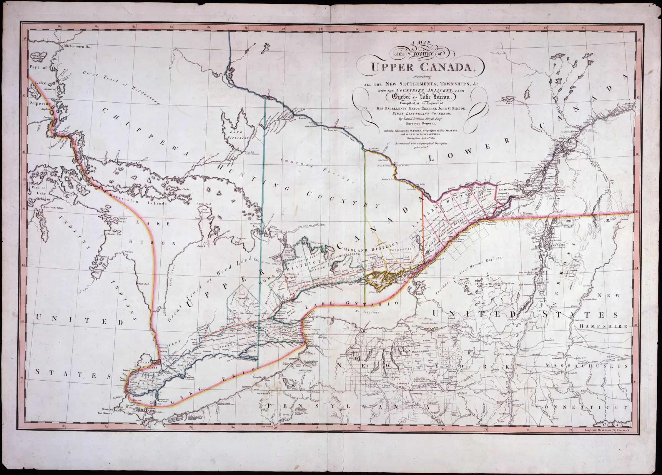
Detail of a map of the Province of Upper Canada, 1800
Detail of a map of the Province
of Upper Canada, 1800
David William Smyth, Surveyor General
Reference Code: C 279-0-0-0-34
Archives of Ontario, I0004758

The political entity we now know as Ontario was originally created in 1791 when it was called Upper Canada. Since that time, in response to population growth and administrative needs, there have been numerous changes to its boundaries, both external and internal. In addition, townships, villages, towns and cities have frequently merged, and counties and districts have re-organized to meet changing needs.

The Archives of Ontario has prepared this guide to provide some background information about changes to Ontario's borders and political composition and includes maps and tables illustrating those changes.

People using records held by the Archives of Ontario can utilize the information in a variety of ways. For example:

  • Genealogists researching a mid-19th century marriage may need to know when counties replaced districts in a given geographical area.

  • A researcher concerned with pre-1867 records will need to be able to make the distinction between terms such as "Upper Canada, 1791", "Canada West, 1840" or "Province of Canada, 1867".

  • University students researching government policies regarding Northern Ontario will find it useful to know about the creation and role of districts in that area.

  • Local historians can use information about municipal re-structuring to locate a village that no longer exists as an independent entity.


Maps of Ontario


Economic Atlas of Ontario, 1969 (détail)
W. G. Dean, Editor/ Directeur;
G. J. Mathews, Cartographer/ Cartographe
Government of Ontario

  • Early Districts and Counties
    Starting in 1788, Districts and Counties became the regional level administrative units. This section details the growth and changes in county and district boundaries over time and briefly outlines the responsibilities of these two levels of administration.

Map 21-6 [Southern Ontario] (détail)
Image from Map 21-6
[Southern Ontario]
Ministry of Natural Resources
Government of Ontario, 1980
  • Districts of Northern Ontario
    This section follows the boundary changes in Northern Ontario since it was first divided into districts in the mid-19th century.

  • Post-World War II Regional Municipal Governments
    Rapid increases in the population and area of major urban centres following World War II motivated a great deal of change in the administrative makeup of much of Ontario. From the early 1950's through the 1970's regional municipalities gradually replaced Ontario's more heavily populated counties.
Map of Southern Ontario
Image from Map
of Southern Ontario
C. Tarling & Co., Map Mounters
and Publishers,
94 Market Street, Toronto
[between 1940 and 1951]
  • Maps of Southern Ontario circa 1951 by County
    Urban development and municipal changes and growth have resulted in many towns and villages being absorbed into other urban centres. These maps show Ontario as it was at the start of the post-World War II urban boom. They will be useful to researchers trying to determine the location of communities not found on current maps.

  • Sources of Information
    Atlases, maps, books, records and web sites used in preparing this material provide additional information on regional and municipal governments.