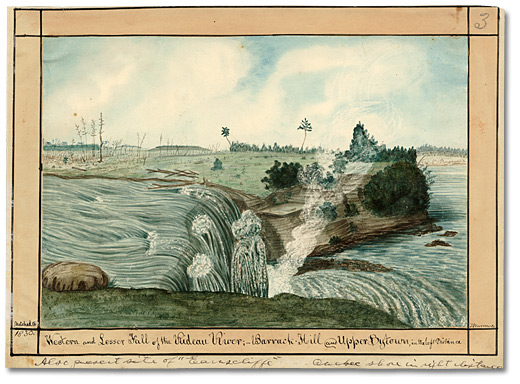
While the Rideau River provided a practical canal route as it pushed north and east through the wilderness from Rideau Lake, it posed a series of problems as it got closer to Bytown. Along its final 9 kilometres (5.5 miles), it became quite shallow and ended with two spectacular waterfalls that dropped 10 metres (30 feet) into the Ottawa River. Another course had to be found for the canal.
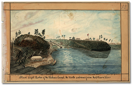
Sleigh Bay, a short distance west of the falls, became the site of the canal entrance. It was chosen because it gave access to a long ravine that cut upward through steep terrain bordering the south shore of the Ottawa River. Boats were lifted up through eight locks to a level where they could navigate a stretch of man-made channel excavated through swamps and forest all the way to Hog’s Back Falls.

Click to see a larger image (331K)
Western and Lesser Fall of the Rideau River; Barrack Hill
and Upper Bytown in the left Distance, 1826
Watercolour
Thomas Burrowes fonds
Reference Code: C 1-0-0-03
Archives of Ontario, I0002120
Thomas Burrowes’s painting shows the strategic benefits of Sleigh Bay, which could have been readily defended from attack by gun batteries placed atop the cliffs that flanked the locks. Limestone from the ravine walls provided building material for the locks and for a series of buildings that Lieutenant-Colonel John By (commandant of the Rideau Canal project) constructed in 1827.
In the painting, Burrowes offers an historic perspective of Barracks Hill, the promontory that was to become Parliament Hill. (The Parliament Buildings were built there between 1859 and 1876.) At the time of the painting, there were three stone barracks and a hospital on top of the hill.
Atop the opposite hill (in modern-day Major’s Hill Park) Lieutenant-Colonel John By’s private residence can be seen in the painting. Below it, on the bank of the Ottawa River, is a wharf and the building that housed the Royal Engineers. Looking up the series of locks, one can see the Commissariat to the right – the only building in the painting that still stands today. It is now a museum.
Beyond the final lock, the Sappers Bridge provided an important link between the two sides of the new waterway. It was demolished in 1912.
Beginning again
For several years before construction started, Lieutenant-Colonel John By urged the British government to design a canal wide enough to accommodate steamboats rather than the batteaux and barges that were commonly used to transport goods and people between Montreal and Upper Canada. By wanted to increase the original 6-metre (20-foot) width by two and a half times, but London refused. Eventually, in June 1828, he received permission to expand the locks to 10 metres (33 feet). Unfortunately, the first three locks were almost complete by that time. The decision pleased By, who realized how important steamship transportation would become in the wilderness province, but it must have discouraged the men who had laboured on the first set of narrower locks.
After workers tore down the stone walls they had built a few months earlier, they encountered a series of problems with underground water and sand which continually flowed out of the walls of the excavated ravine. Pumps were used to move water out of the works, and a wall was constructed to keep the sand from filling the locks.

Click to see a larger image (291K)
First Eight Locks of the Rideau Canal, the North entrance
from the Ottawa River, 1834
Watercolour
Thomas Burrowes fonds
Reference Code: C 1-0-0-0-13
Archives of Ontario, I0002131