
Previous | Home | Next
How could it happen? | Images of the Fire | Animation
Model | Two Success Stories | Sources and Resources
This animation shows the approximate path of the fire as it progressed from 8:00 on the evening of April 19th until it was finally brought under control at 5:00 am on April 20th.
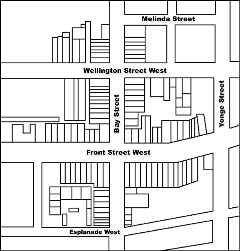
This animation is based on a map that appeared in 1981 in Volume 17 No. 3 of the IAO Inspector, a publication of the Loss Control Engineering Department of Insurer's Advisory Organization of Canada. It formed part of an article written by: R. J. Tatton, Loss Prevention Representative, Insurance Corporation of Ireland.
Previous | Home | Next
How could it happen? | Images of the Fire | Animation
Model | Two Success Stories | Sources and Resources