Table of Contents
Home | Peoples and Events Shaping Treaty No.9 | The Treaty No.9 Expedition of 1905-1906Developing the Treaty Relationship, 1905-2005 | The James Bay Treaty - Treaty No.9
Adhesions to Treaty No. 9 | 2013 Mushkegowuk Council Conference | About the Title Images
The Royal Proclamation of 1763 established guidelines for the European settlement of Aboriginal territories and recognized Aboriginal rights and titles. Having defined the protocols by which the British Crown could negotiate treaty agreements, a series of covenants were negotiated over the centuries across the Maritimes, Quebec, and southern Ontario. As settlement spread to the Prairies after Confederation, a series of “numbered treaties” were started in 1871, dealing with the lands from the Lake of the Woods to the foothills of the Rocky Mountains.
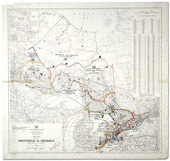
Click to see a larger image (432K)
[Map showing Indian treaties in Ontario] James L. Morris, [base] Map of the province of
Ontario: Dominion of Canada. Map No. 20a. Ontario: Department of Surveys, 1931
J. L. Morris fonds
Reference Code: F 1060-1-0-51, Folder 1, map 14, 13356 (63/5)
Archives of Ontario, I0022329
The map above shows the treaties that cover Ontario as it now exists. Originally, the province’s northern boundary was the Ottawa River and the watersheds of Lakes Huron and Superior. Possession of the lands west of Lake Nipigon was disputed by Ontario and Manitoba until the Federal Government divided it in 1881 and half was transferred by the Imperial Canada-Ontario Boundary Act in 1889. The three Robinson Treaties of 1850 and 1854 and Treaty No. 3 of 1873 were signed to surrender Aboriginal title to these areas.
The “‘numbered” treaties before 1905 feature a standard set of provisions. In exchange for surrendering their lands, the Aboriginal signatories received monetary compensation (a one-time gratuity, followed by perpetual annuities), reserve lands, and recognized hunting, fishing, and gathering rights. However, in each case, the government expected the First Nations peoples to settle down on their reserves and take up an agricultural lifestyle. This was not possible for the hunter-gatherer lifestyle of the Cree, Ojibway, and OjiCree peoples of the Arctic watershed.
While the ninth in the numbered treaty series, this document is more commonly called the James Bay Treaty as it initially dealt with that part of the Arctic watershed that was south of the Albany River and drained into James Bay. The lands north of the Albany River, known as the Patricia Portion, remained part of the Northwest Territories until it was finally divided between Ontario and Manitoba.
|
The original Treaty No. 9 document. Some Aboriginal leaders signed by touching a pen as an ‘X’ mark was inscribed next to their names, while others signed in syllabic writing. |
Getting the signatures to surrender Aboriginal title to the land south of the Albany River took the summers of 1905 and 1906. Representing the Crown were, for the Federal Government, Duncan Campbell Scott and Samuel Stewart of the Indian Affairs Department, and, for the Ontario Government, lawyer Daniel McMartin from Perth, Ontario. Accompanying the tour party was North Bay physician Dr. A.G. Meindl, and Dominion Police Constables James Parkinson and J.L. Vanasse.
![James Bay Treaty (Treaty No. 9) [page 5]](pics/treaty_9_pg_5_300.jpg)
Click to see a larger image (1.0MB)
James Bay Treaty (Treaty No. 9) [page 5]
Reference Code: RG 1-653
(Articles of James Bay Treaty (Treaty No. 9))
Archives of Ontario
Four days after their appointment, the Treaty No. 9 Commission left from the C.P.R.
station at Dinorwic and raced up the Albany River holding signing feasts at the
trading posts at Osnaburgh (July 11), Fort Hope (July 18), Marten Falls (July 25),
Fort Albany (August 3), Moose Factory (August 7), and New Post (August 19). The
next year, using rail and water, they visited the signing sites of Matachewan (June
19), Mattagami (July 7), Flying Post (July 16), New Brunswick House (July 25), and
Long Lake (August 9).
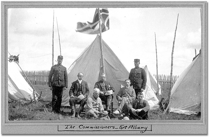
The photograph below shows the Treaty No. 9 Commission at Fort Albany near James Bay in 1905.
Click to see a larger image (248K)
The James Bay Treaty signing party at Fort Albany.
Standing: Joseph L. Vanasse (L), James Parkinson (R) of NWMP.
Seated: Commissioners Samuel Stewart (L), Daniel George McMartin, Duncan Campbell Scott (R)
Foreground: HBC Chief Trader Thomas and an unnamed individual, August 3, 1905
Photographer unknown
Duncan Campbell Scott fonds
Black and white print
Reference Code: C 275-2-0-1 (S 7546)
Archives of Ontario, I0010627
At that time, Cree, Ojibway, and OjiCree First Nations operated in an oral, not
a written, tradition. As few Aboriginal leaders spoke fluent English, the Commissioners
relied on local priests and Hudson's Bay Company (HBC) staff to explain the Treaty’s terms. As no translated
version of the treaty was left behind and the Commissioners only spent a day at
each signing site, there now is disagreement as to what the Aboriginals actually agreed
to and whether each side understood the other’s terminology.
The Treaty No. 9 expedition paddled down the Abitibi River. HBC river guide James Swain and his experienced teams of First Nations canoeists were required to navigate the rapids, cross the endless portages, and get the expedition to each signing site and back before winter set in. Besides food, tents, clothing, and cooking utensils for every person, the supplies included a view camera with glass negatives, twelve-foot long Union Jack flags, a strongbox holding silver treaty medals and thousands of dollars in small bills, and two copies of the treaty on parchment.
![Photo: En-Route -- Abitibi River, [ca. 1905]](pics/10557_canoe_ab_r_700.jpg)
En-Route -- Abitibi River, [ca. 1905]
Photographer unknown
Duncan Campbell Scott fonds.
Format: Black and white print
Reference Code: C 275-2-0-2 (S 7569)
>Archives of Ontario, I0010557
After signing ceremonies at each post, Crown and Aboriginal representatives celebrated the agreement by holding a feast and making formal speeches pledging to uphold the terms and spirit of the Treaty.
In the photograph below, bannock bread has been prepared for the feast following the first signing ceremony conducted at Osnaburgh House trade post, on Lake St. Joseph, at the headwaters of the Albany River.
Click to see a larger image (70K)
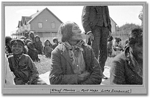
Chief Moonias waiting for the Treaty signing
ceremony, Fort Hope, July 19, 1905
Photographer unknown
Duncan Campbell Scott fonds
Black and white print
Reference Code: C 275-1-0-6 (S 7528)
Archives of Ontario, I0010653
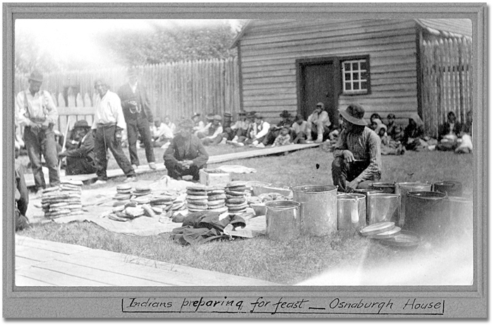
Click to see a larger image (232K)
Preparing the feast to be held after the James Bay Treaty signing ceremony,
Osnaburgh House, July 12, 1905
Photographer unknown
Duncan Campbell Scott fonds
Black and white print
Reference Code: C 275-1-0-2 (S 7518)
Archives of Ontario, I0010715
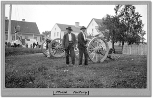
Click to see a larger image (265K)
The Hudson's Bay Company post, Moose
Factory. Note the Commissioner's annuities
tent in the background, August 10, 1905
Photographer unknown
Duncan Campbell Scott fonds.
Black and white print
Reference Code: C 275-1-0-3 (S 7551)
Archives of Ontario, I0010731
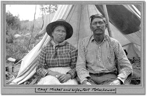
Click to see a larger image (257K)
Chief Michel Baptiste and wife, at the Fort Metachewan signing ceremony, July 20, 1906
Photographer unknown
Duncan Campbell Scott fonds.
Black and white print
Reference Code: C 275-1-0-5 (S 7658)
Archives of Ontario, I0010708
Previous | Home |
Next
Peoples and Events Shaping Treaty No.9 | The Treaty
No.9 Expedition of 1905-1906
Developing the Treaty Relationship, 1905-2005 |
The James Bay Treaty - Treaty No.9
Adhesions to Treaty No. 9 | 2013 Mushkegowuk Council Conference |
About the Title Images