
The Evolution of Ontario's Boundaries - 1876
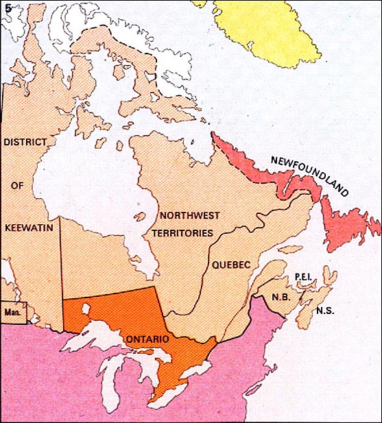
After the purchase of Rupert's Land by Canada in 1868. Ontario's boundaries moved west and north to a "provisional" boundary in 1874.
Map scanned from the
Economic Atlas of Ontario / Atlas Économique de l'Ontario
W. G. Dean, Editor/ Directeur; G. J. Mathews, Cartographer/ Cartographe
Printed 1969 by University of Toronto Press for the Government of Ontario
The Evolution of Ontario's Boundaries 1774-1912 Home
1774 | 1791 | 1840 | 1867 | 1876 | 1880 | 1889 | 1912